I am always interested in walls and like to photograph these. As we walked down the lane a few days ago I took a picture of an interesting wall at the front of a substantial house. On getting home I looked at the brickwork and started working out how it was built. The bricks looked old and the build was irregular. The middle part appears to be English Bond, where one course is placed long ways and the next is placed at end ways at right angles. This gives a strong single brick thick layer of wall if the whole wall is made like this.
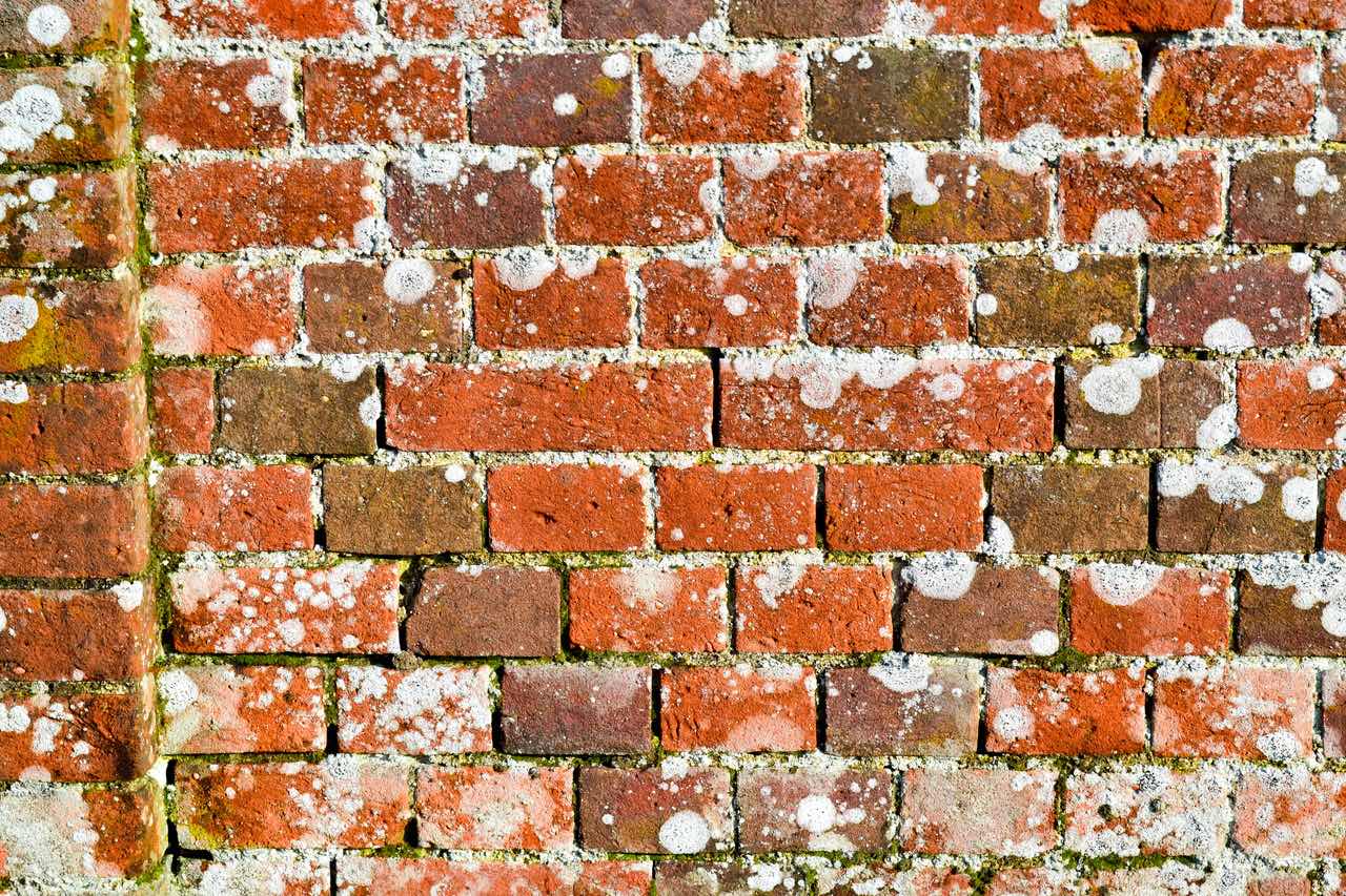
I was cross that I had not looked at the bricks of the house. When Michael wanted a stroll the next day he sketched the placement of these bricks.
The structure of the walls of the house
This is a Flemish Bond and broken bricks can be used in the build. It is not such a strong wall but is thought to demand more skill in getting the brick placement exactly correct.

This observation of this local wall set me of on some research on local housing!
The brick house is in fact one of the many listed houses in a small area. It was built as an early 17th Century timbered frame house with a north wing, so quite a large house in those days. In the 19th century this house was bricked round completely and a west wing was built, which fronts the lane. Hence I had thought it was a much ‘newer house’.
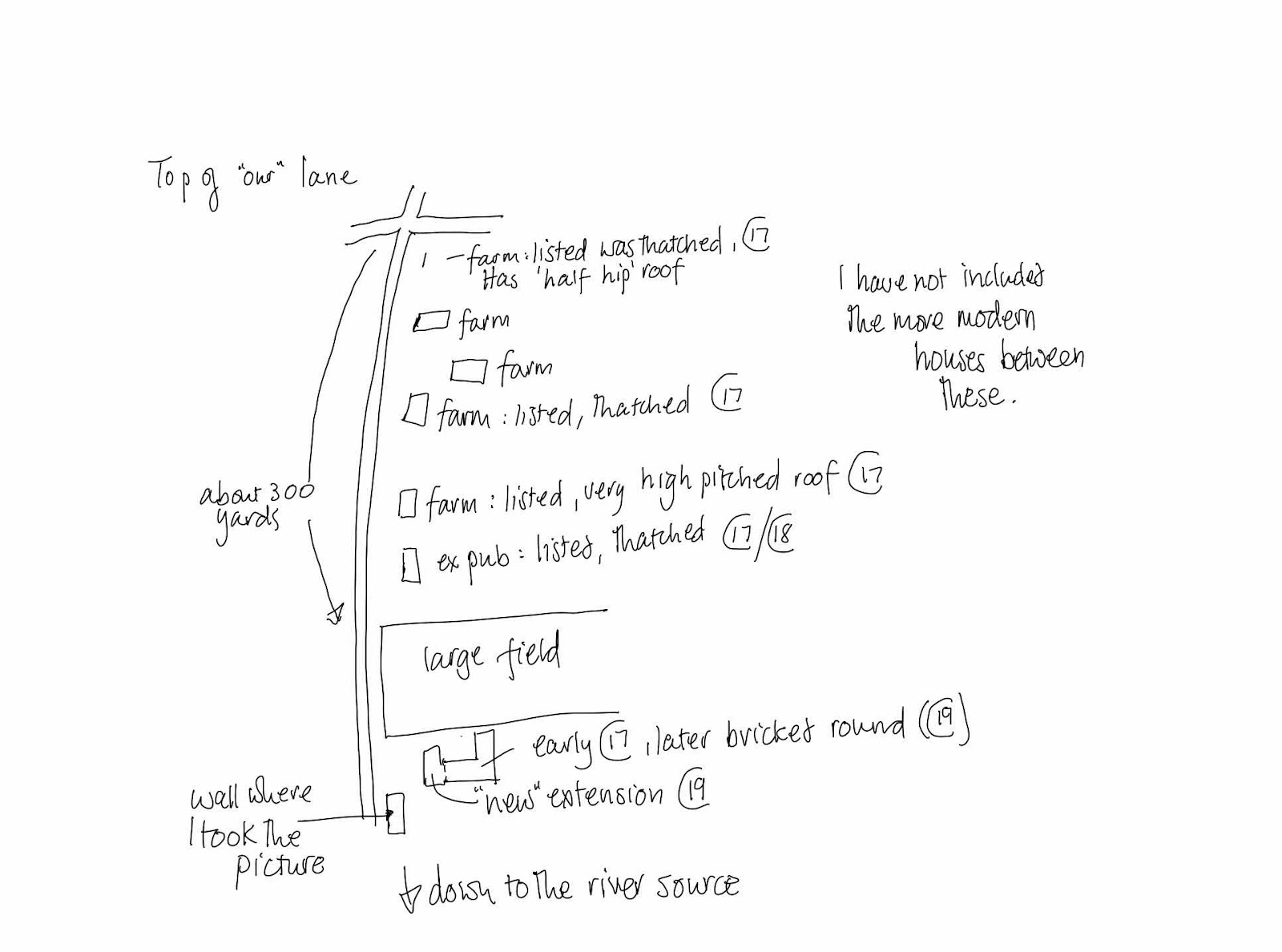
Starting at the North end of ‘our’ lane there are, all on one side of the road, in fact 4 other listed buildings, 3 of these are farmhouses and 2 of the buildings are thatched. (The Grade 2 listing notes that one of the other farms is thatched but it is not thatched now). The farm house nearest to us has such a pitched roof it must have been thatched too at some time.
In this area there are another couple of houses called farms. In 300 yards there are 5 farms, and an old building that was a public house. This latter was one of 3 in the village that are now all closed. There is then a field and this larger house and barn complex , lived in by a local farmer which is also a listed building and where the wall is.
I have been surprised since we moved here that there are so many farms in such a small area. Then I began to work out why.
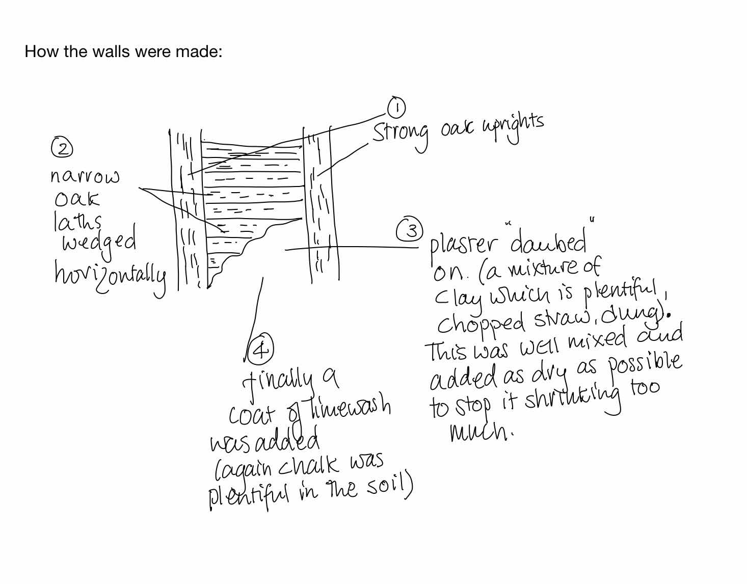
Oak (and to a lesser extent Hazel) were woods used in building and thatching. Hazel is much more flexible than oak.
The infill between the oak frame is likely to be something like this:
When we lived in Norfolk, before our spell in Cheshire, we owned and lived in a thatched 17th century cottage outside Diss for 16 years. We learnt much of the history of the building when we lived there and I will write about it sometime.
Thinking back to our lane and all the farms! Until relatively recently the land on the other side of the lane to us was common land and probably going back to the 1600’s could have been used for grazing. Sheep were an important animal and were the basis of the local weaving industry. Norfolk was a very (if not the most) populated county around that time and Norwich was second only to London in terms of wealth.
Going back even further, thanks to an archeological survey carried out in the village a few years back under the auspices of Cambridge university, we know quite a lot about earlier village inhabitants.
Sticking out into the North Sea, Norfolk had many peoples arrive by sea. The river Tas was larger in those times and Palaeolithic remains have been found on land rising from this.
The area in the middle of Norfolk, roughly running north/ south was a central forest zone on a clay heavy soil. Once tamed this was extremely fertile land and the region could support a high population. Today agriculture is still by far the most predominant use of the land. The cloth industry was labour intensive, but the rich soils could support the sheep, and be good for growing both flax for the linen industry as well as corn to feed the population. Norwich was close to the continent and probably easier to transport cloth to, then getting it to London by road. And so for many years this was how people lived and worked here.
Several Bronze Age and Roman items have been unearthed and by Saxon Times there is evidence that there was a settlement in this area of the village that I am describing. Perhaps having all these farms goes back to that time, and hence why there are so many farms in such a small area.
More research needed and all this interest just from taking a photo of a brick wall.
Fascinating read - thanks Janet!
ReplyDeleteThanks
Delete